Climate/Weather Category
The Cienega Watershed is located in Southeastern Arizona where the climate is characterized by a bi-modal seasonal distribution of precipitation, with summer originating from the North American Monsoon, winter originating from cyclonic storms tracking east, and distinct dry conditions between each season. Climatic variability is high and drought is common.
The Climate/Weather category covers records on precipitation, drought, flood, storms, and temperature; information may include event duration, severity, and impacts on livestock. We also added long-term data on precipitation, temperature, and the standardized precipitation and evapotranspiration index (SPEI, a drought index, with zero being average and negative indicating dry). For example, you will find ample entries on the severe drought that occurred around 1900, along with a distinct SPEI valley resulting from years of sparse rainfall. The extensive late 20th-early 21st-Century drought is due to a combination of warming temperatures and precipitation deficits
Sub-categories (Tags): Change, Droughts, Floods, Patterns, Precipitation, Storms.
Fauna Category
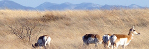
The Fauna category includes records that refer to local fish and wildlife species and their habitats. Most records for wildlife come from the historical period. Pre-historical records are rare, and do not constitute absolute records. Similarly, records of animal sightings from long ago are not always absolute. An example is the beaver: many assume it occurred in the Santa Cruz River basin, but there are no physical specimens of beaver, including in excavations of prehistoric sites.
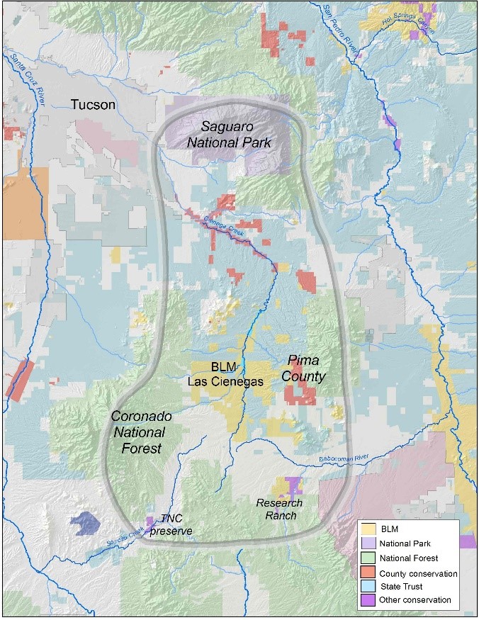
The area surrounding Cienega Creek is well known for diversity of species and vegetation communities. Cienega Creek itself is a focal point for the area. It is unique because no non-native fish have invaded and the creek and environs harbor three endangered fish, an endangered snake, two endangered birds, and one aquatic plant. There are two rare and decreasing habitat types in the area: desert grasslands and cienegas (marshes).
Sub-categories (Tags): Species, ESA status (Endangered Species Act; includes both endangered and threatened species), Introduction of a species, Loss of a wildlife species or its habitat, Non-native species, and Wildlife studies

History Category
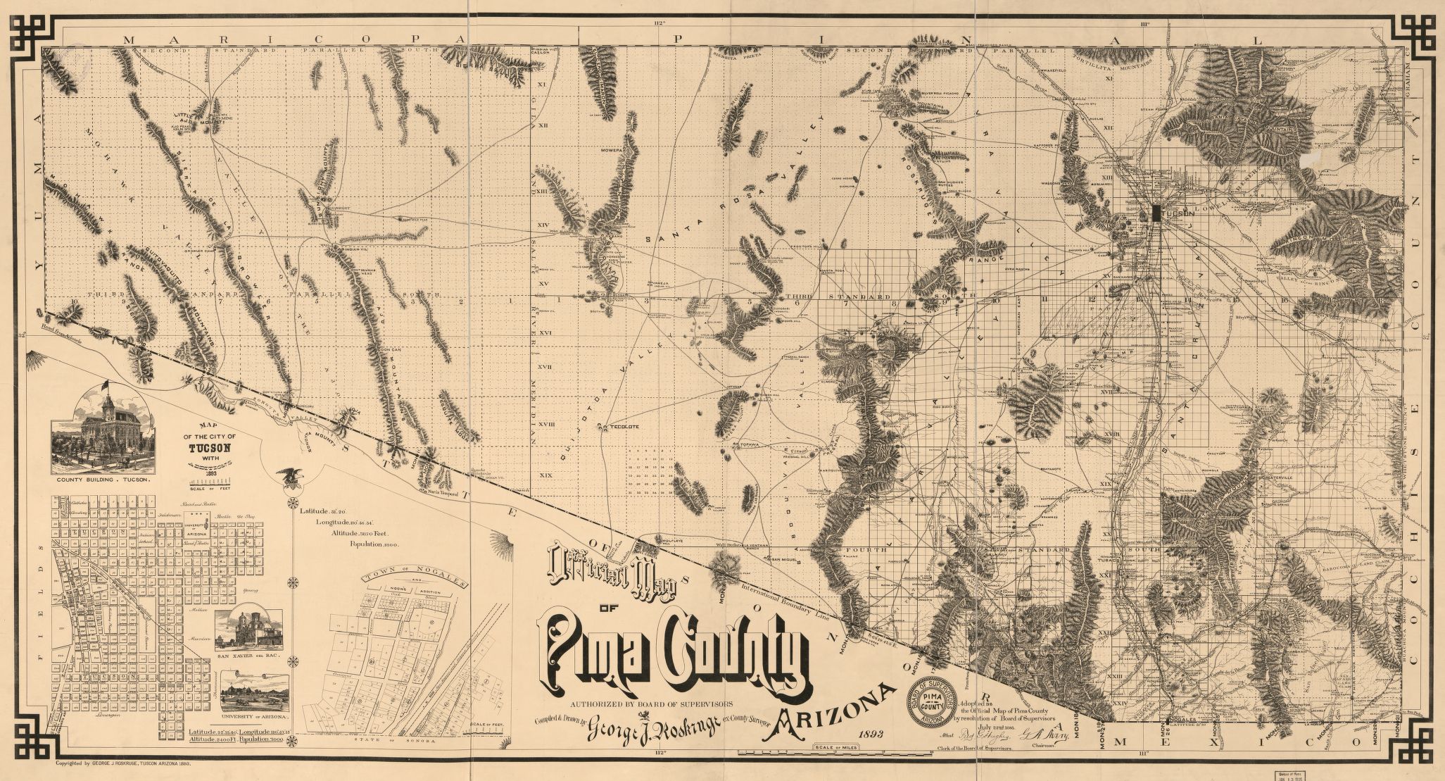
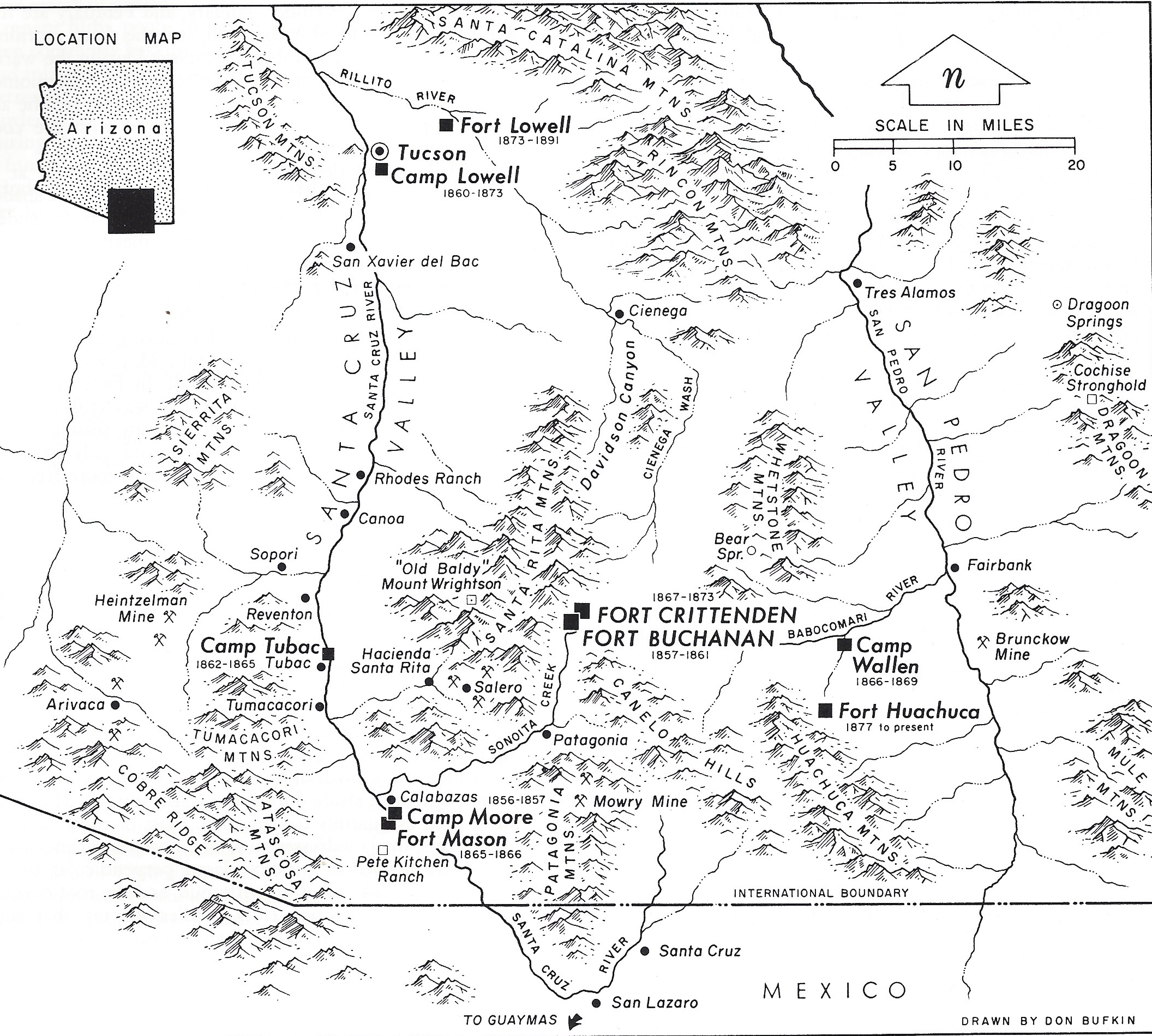
The History category includes historical events that occurred in or affected the Cienega Watershed. Events listed record the history of institutions, municipalities, organizations, or individuals, and include the establishment and development of ranches like the Empire and Posta Quemada, and of municipalities like Vail, AZ. Significant local, state, national, or international historic events such as the arrival of the Southern Pacific Railroad, Arizona statehood, the Gadsden Purchase are also recorded. The category does not include events during prehistoric eras.
Sub-categories (Tags): Arizona, Bureau of Land Management, Cienega Watershed Partnership, Colossal Cave Mountain Park, Empire Ranch, Inventions, Kentucky Camp, Mexico/Spanish, Military, Research Ranch, Sonoita Valley, U.S. Forest Service, United States.
Land Forms and Processes Category
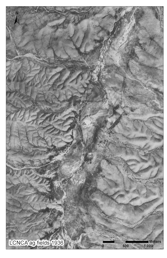
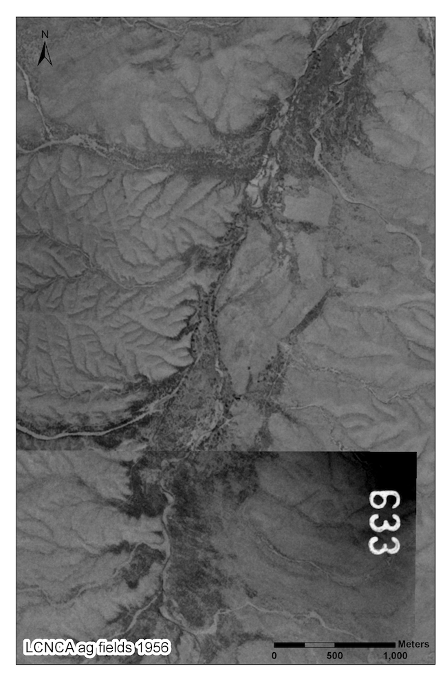
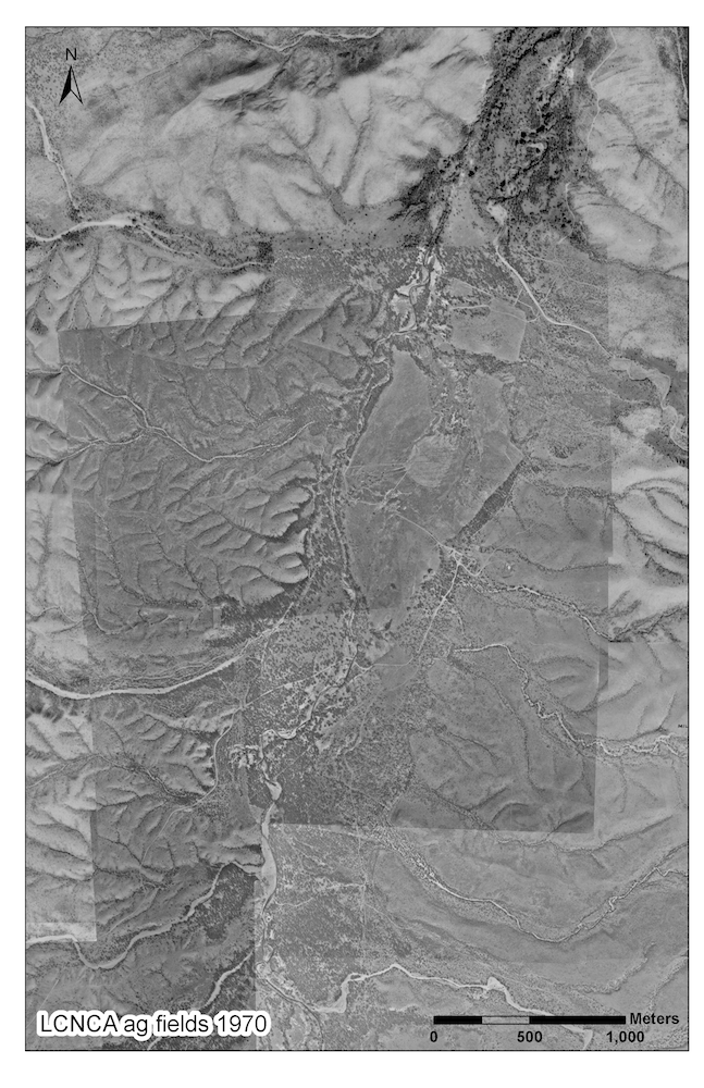
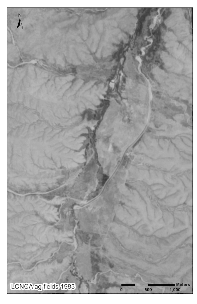
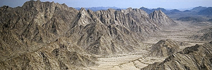
The Land Forms and Processes category addresses a variety of forms, features, and events in the natural landscape, along with the imagery we use to understand these processes. The basic geology, soils types, and landscape features are still being systematically mapped but, starting in 1936, aerial imagery has been applied to aid in understanding the results of large-scale events. Some events are famous, like the 1887 series of earthquakes in the region (see also the History category). Fires are a common occurrence on the landscape and include both natural fires and human-caused fires: accidental, deliberately set, and prescribed. Some landscape features are tied to periods of downcutting and erosion in the past; now erosion is a concern as climatic variables change, and in the face of increasing human impact on the watershed resources. Creeks are also covered under Water, and droughts and floods are listed under Climate/Weather.
Sub-categories (Tags): Aerial Imagery, Caves, Creeks, Earthquakes, Erosion, Fire, Geology, Other Natural, Soils, Paleontology.
Land Use Category
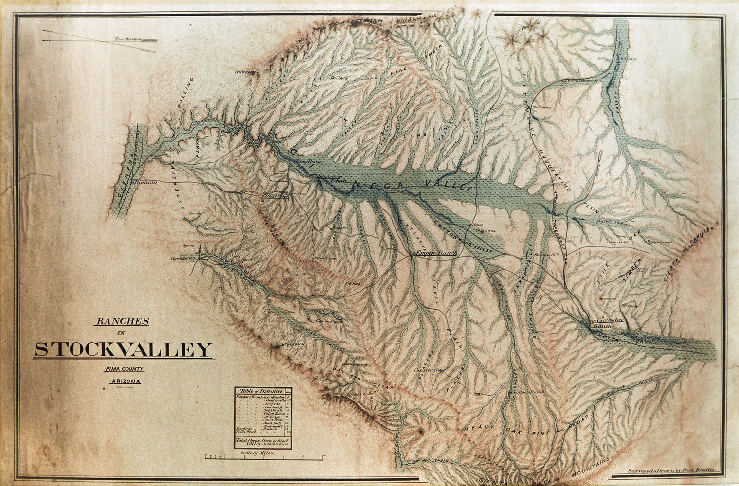
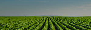
The Land Use category includes a variety of actions taken and activities instigated by people on the landscape of the Cienega Watershed. Surveyors came through marking boundaries and recording early observations. Homesteaders and miners made claims as they assessed different sites in the valley for important natural resources such as soil, vegetation, and minerals. Ranchers, like the Vail and Boice families, bought land parcels to control the grasslands for their cattle and sheep more effectively. Most were looking to build homes and to succeed economically on their land. Transportation was a key factor in the development of the valley. Early roads were constructed for shipping freight and moving stagecoaches. Later the railroads dominated all other forms of transportation.
During the modern era, the Cienega Valley became a popular site for the cowboy and western movie industry. Large-scale development by mining corporations and residential developers has threatened this fragile landscape. Today university scientists, non-profit organizations, concerned citizens, and residents work to preserve and restore the landscape to a healthier state.
This category does not include activities specific to water; neither does it include actions and activities during prehistoric eras.
Sub-categories (Tags): Development, Economics (grazing, mining, farming), Entertainment, Land Status, Planning, Recreation, Restoration, Transportation. This category does not include activities specific to water; neither does it include actions and activities during prehistoric eras.
People Category
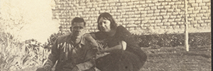
The People category includes individuals, families, organizations, and groups tied to ethnicity, language or other affiliations known from historic records and other documentation. Allied closely with the History category, events in this category provide the contributions of a wide range of individuals from explorers and military leaders to ranchers, miners, land managers, and conservationists. Families associated with ranch developments and mining activities include the Vails, Sanfords, Hummels, Boices, and Donaldsons. The presence of Native American groups like the Apache, Sobaipuri, Pima, Papago, Tohono O’odham, and neighbors are noted in the watershed and neighboring areas. Eventually organizations were formed, such as rodeo associations, local citizen groups like the Sonoita Valley Planning Partnership, and a variety of non-profit groups like the National Audubon Appleton-Whittell Research Ranch, Empire Ranch Foundation, and the Cienega Watershed Partnership. Education and youth groups in the watershed include volunteer activities and more formal programs like Wild About the Grasslands! and Youth Engaged Stewardship (YES!).
Sub-categories (Tags): Anglo or European, Families, Individuals, Mexican, Native Americans, Organizations, Other Ethnic or special groups, Spanish, Youth.

Flora Category
The Flora category includes information on vegetation communities and habitat types as well as plant species. For example, you’ll find observations about “open grasslands” in the 1800s or the change from woodlands to grasslands across the valley as the last ice age ended (Vegetation Communities sub-category). You’ll also find observations of a native plant like Huachuca water umbel being put on the endangered species list (ESA Status sub-category), or an exotic plant like Lehmann lovegrass being introduced or spreading (Non-native sub-category).
The Cienega Watershed’s basic vegetation patterns feature a broad grassland valley with a forested stream running northwards through the center. There are patches of marsh called “cienegas” in and near the stream, and expanses of both sacaton grasslands and mesquite bosques in the floodplain. The valley is surrounded by forested mountains at upper elevations, and gives way to desert at low elevations.
Overlap between this and other timeline categories is common. Flora events may refer to vegetation conditions, e.g. in response to Climate/Weather events like droughts, or Land Forms and Processes events like fires. Many Flora observations relate to Fauna observations, e.g. as changes in habitats affect animal populations, or to Water observations as changes in stream flow affect river forests and vice-versa.
Sub-categories (Tags): ESA status (Endangered Species Act; includes both endangered and threatened species), Non-native Species, Vegetation Communities, and Studies.
Prehistory Category
Prehistory provides two time spans: paleontological eras beginning 145 million years ago; and the last 10,000 years before the present, when people began living in the watershed, up to AD 1500 (when historical records first become available). Specific Native American communities may be found under the timeline categories of History or People.
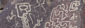
Investigations listed in the timeline include organized surveys and excavations and informal discoveries that cover paleontology localities and prehistoric sites, as well as investigations at historic mining and ranching locations like Rosemont. No Paleo-Indian sites are known in the watershed although mammoth bones are found. Archaic sites represent a long span of over 7,000 years when the settlers were hunting and gathering for their subsistence. Late Archaic agricultural sites occur in well-watered areas. Later in time, Hohokam village sites were sometimes occupied for years. Hohokam sites have produced large amounts of pottery, bones, tools, architecture, and evidence of corn-based agriculture and regional trade.
Sub-categories (Tags): Archaeological sites, and Studies; and the time divisions that conveniently divide human settlement in the watershed: Archaic, Classic/Hohokam, Early Ceramic, Late Archaic, Paleo-Indian, and Protohistoric. Paleontology is found under the Land Forms category.

Legislation/Policies Category
The Legislation/Policies category includes significant legislation (i.e. laws) or policies (i.e. a course or principle of action) that influenced events in the history of the Cienega Watershed. For example, the 1862 Homestead Act encouraged settlement of the Watershed, and the Endangered Species Act of 1973 regulates the conservation of species that are endangered or threatened, and the conservation of the ecosystems on which they depend. In instances where a legislative act or policy created governmental entities (e.g. the Department of Agriculture or the Coronado National Forest), the timeline entry describes the establishment of the entity rather than the legislation/policy itself.
Sub-categories (Tags):County, Federal, State, Other--identify the types of entities that issued the Legislation/Policies.
Water Category
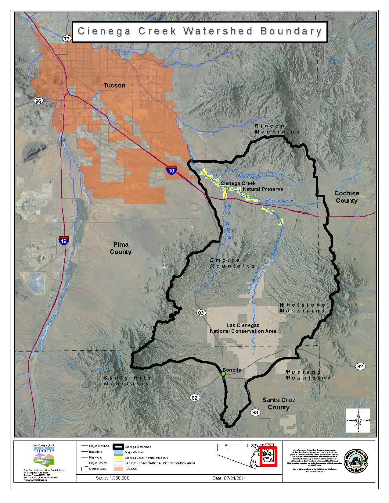
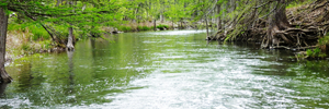
The Water category includes both natural water sources like springs and cienegas (marshes), and water uses ranging from water rights to wells. The Cienega Creek runs through the Cienega Watershed like a ribbon of green vegetation with water flowing in some areas permanently. Springs and cienegas exist in specific locations depending on amount of precipitation and groundwater paths. Both groundwater and surface water flows are critical to maintaining watershed natural resources and supporting human activities. Studies provide annual wet/dry counts and isotopic profiles of water in the creeks, springs, cienegas, and wells. Inventories of springs today show that these were in use for hundreds of years. As agriculture developed and later ranching and mining activities commenced, water use created significant features on the landscape. Wells increasingly dot the landscape as new residences and enterprises like wineries increase.
Sub-categories (Tags): Cienega Creek, Groundwater, Springs, Surface, Water developments (wells, tanks), Water rights, Cienegas, Studies.